Santa's Workshop - This is a major source of revenue for Santa Claus. He has to fund that workshop he has at the North Pole somehow! I do believe a Santa clone is running this place while the real Santa takes the Summer off.
 |
| image source While sitting in the snack bar eating our donuts, we were amazed at the quantity of gnats that were everywhere. A person couldn't walk outside without breathing in a few or having them fly into your mouth. |
 |
| Gnats on window at snack bar - yes, they are on the inside of the window |
 |
| Kinda hard to see, but the roof of the trusty roadtrip car was covered with gnasty gnats! |
Ravens were a common sight on both the drive up and back. Pairs of them could be seen cavorting in the air around the Summit House. I imagine they were feasting on the gnats!
Glen Cove Inn - Back in the Day, there was a ski area located here, which consisted of two runs. It is now just a gift shop and picnic place. There is a checkpoint located here for the vehicles traveling downhill/ A Ranger will check the temperature of the vehicle's brake pads. If the temperature is over 300deg, then the car must be parked until the brake pads cool off. The road up Pikes Peak is uphill to the top and downhill to the bottom. Driving in low gears is a must!
 |
| Checkpoint for brake temperature |
Not too far from the Summit is a place called the Devil's Playground. It is so named because of the way lightning jumps from rock to rock during a thunderstorm. There is no cover on the mountain at this elevation. Not a place a person would want to be in a thunderstorm!
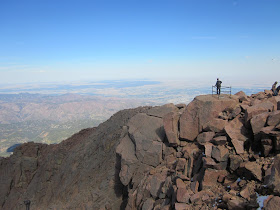
It was interesting how the rocks along the ridges would stick up. They looked like the spines or plates along the back of dinosaurs.
This is the burial marker of Carl Lotave. His ashes have been interred below the marker. Carl Lotave was a Swedish born painter who moved to Colorado Springs in 1899 to paint Native Americans for the Smithsonian. His burial place is in the granite boulder field to the southwest of the Summit House.
Another interesting marker is located waaayyyyyy out on a rock ledge to the west of the Summit House. It is a Masonic (?) plaque/time capsule.
And now for the views. It is said that on a clear day - which is so hard to come by any more, what with air pollution and smoke from wildfires - a person can see from Denver in the north, to the Continental Divide to the west, to New Mexico in the south, and Kansas to the East. The Arkansas River can also be seen to the southeast.
 |
| Looking down and to the east towards Colorado Springs. Garden of the Gods in in the center of the photo |
 |
| Looking to the southeast towards the city of Pueblo and the Arkansas River |
 |
| Looking to the west and the Continental Divide |
 |
| Looking to the southwest at the gold mine at Cripple Creek |
I highly recommend this trip to anyone who visits this area. The road is open year round - weather permitting. So much history. So much beauty.
And despite the sheer drop-offs along the road, it really is a nice road. Just don't look down!


